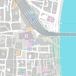
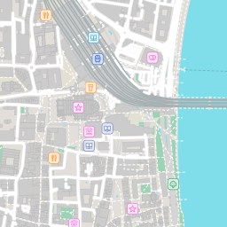
Welcome to the experimental Linked Data wrapper for the Protomaps basemap: OpenStreetMap data cut into Web-Mercator tiles, served per tile as Linked Data and as a picture. The data is © OpenStreetMap contributors under the Open Database License. Each build is one dated PMTiles archive from build.protomaps.com, pinned: a URI here always means the same bytes.
The map is cut into square tiles, as on any web map: at zoom level z the world is 2z × 2z tiles, numbered x from west to east and y from north to south. At zoom 15 a tile in Germany is about 600 m across. A build is one dated copy of the map, named by its date.
20261102/15/17017/10978 — one tile20261102 — the buildtile?s=20261102&layer=light&z=15&x=17017&y=10978tile.svg?s=…
(also tile.png, tile.ttl, tile.nt).feature?bbox=W,S,E,N — the features of a box&zoom=, default 15, at most
16 tiles), cut to the box, each keeping its tile's name; &typenames=pois,roads.major_road
keeps some classes only. As feature.ttl, feature.nt,
feature.json (GeoJSON),
or the box as a picture: feature.png,
feature.svg.viewer — the mapvocab — what the features arehighway, major_road, minor_road, path
or rail; a point of interest a cafe, pharmacy,
bench and so on. Each layer and each kind is a class in one document,
vocab: vocab#roads is a road,
vocab#roads.major_road a major road. The layer is part of a kind's name
because some kinds occur in several layers (landuse.park is a park's area,
pois.park its point). Every feature is a vocab#Feature and is
typed with its kind./indexindex#protomapswrap), its build, and the builds it serves./statusstatus.ttl./routesroutes.json, routes.ttl).Each tile is drawn at 256 px, as PNG or
SVG (the same drawing), after the basemap's
"light" style: areas, water, buildings, roads, rail, boundaries, and icons for points of
interest. No text labels. A point of interest is drawn from the zoom Protomaps give it
(min_zoom): at zoom 15 a station or a museum, most shops and cafés from 16,
benches from 17; an icon that would cover another is left out. At zoom 18 every feature is
drawn: points of interest without an icon (trees, street lamps, …) and icons without room as
dots, address points as small grey dots, places as rings, areas and lines the style leaves
out faintly. The RDF and GeoJSON of a tile list what its picture shows, and only that.
Data © OpenStreetMap contributors, under the
Open Database License; basemap
© Protomaps. Icons: Mapzen (MIT) and Protomaps, see
icons/LICENSE in the source. Limit without an API key (Authorization: Bearer):
2000 pictures and 50 other requests per 10 minutes per client.